NAFPAKTOS - PANAITOLIKO - KARPENISI (ORINI NAFPAKTIA / SOUTH EVRITANIA) • HIKING MAP / ANAVASI
9,50 €
NAFPAKTOS - PANAITOLIKO - KARPENISI (ORINI NAFPAKTIA / SOUTH EVRITANIA) • HIKING MAP / ANAVASI
978-960-9412-78-0

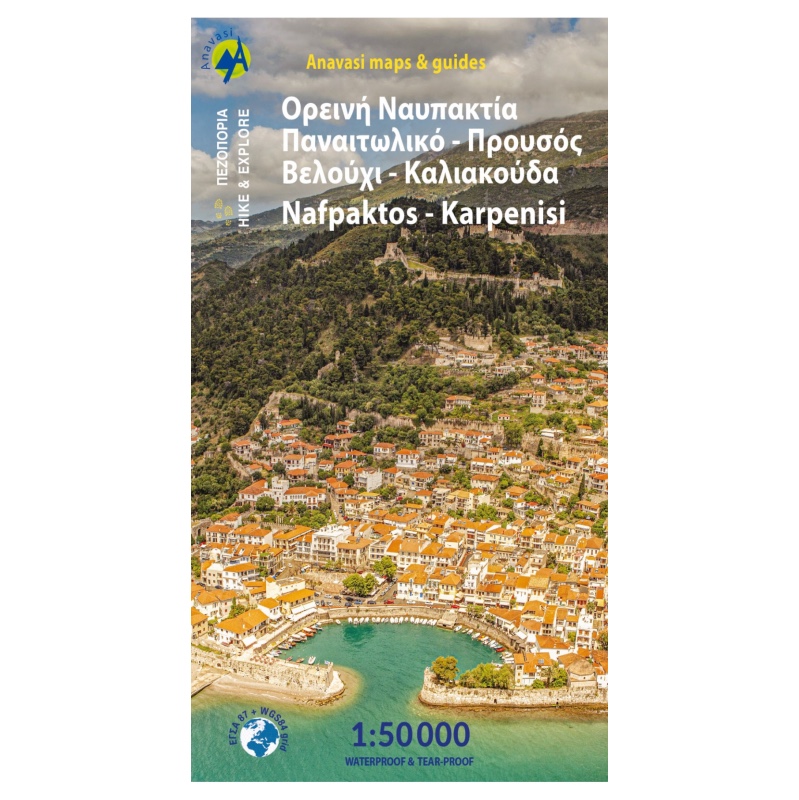


Hiking map for the area of Nafpaktos and Panaitoliko, Karpenisi and south Evritania in scale 1:50 000.
Read the article in local newspaper Empros for this map.
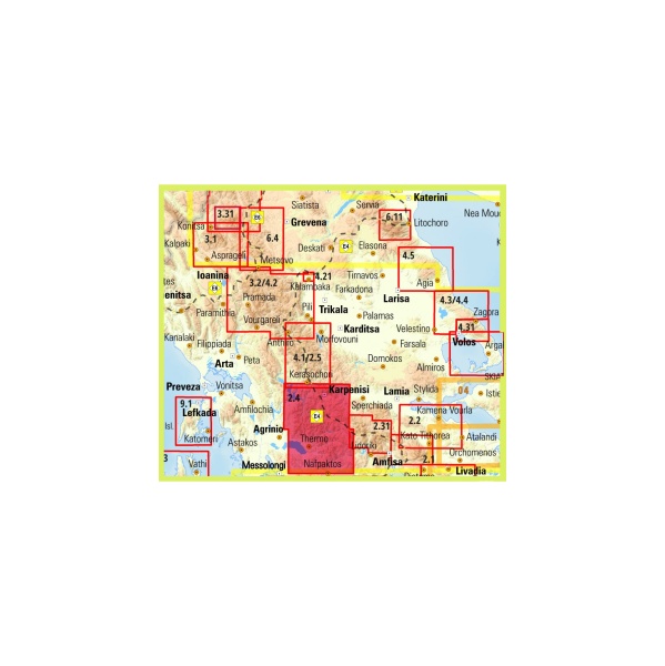
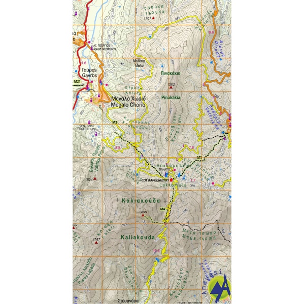
The mountains of Evritania: Velouchi, Chelidona, Kaliakouda and Panetoliko on one side, and on the other the mountainous Nafpaktia area, where Anninos, Tsekoura, Ardini and Tsakalaki . On the proposed routes you will find climbs to the tops and beautiful hikes from village to village or to a bridge, waterfall, forgotten monastery.
Read more about the area of Upland (orini) Nafpaktia and hike to mount Tsekoura.
Map printed on polyart paper.
Brand
Anavasi
Please sign in so that we can notify you about a reply